Friday, November 25, 2011

Waterfalls of the Warrior Mountains

Waterfalls of the Warrior Mountains


The overlying layer of sandstone in the Warrior Mountains has given away to erosion, thus creating some 400 miles of rugged sand rock walled canyons.  Plunging into these canyons are steams and creeks creating hundreds of waterfalls.  The winter and spring seasons are the most ideal times to hike into the canyons of the Warrior Mountains to view the many spectacular waterfalls hidden deep within the forest.  Most of our waterfalls are seasonal but during rainy seasons, these waterfalls are perhaps the most exquisite waterfalls and their surrounding scenery found anywhere in the world.  

Kinlock Falls

In addition to the waterfalls, many springs with clear fresh water flowing from limestone crevasses are found throughout the Warrior Mountains.  Many of these springs erupt at the edge of the Moulton Valley where the land abruptly rises from flat land at some 650 feet in elevation to the rim of the hills at some 1,000 feet above mean sea level, thus creating the Continental Divide which separates the waters in north-south directions.  South of the rim, which creates the back bone of North Alabama, has streams of water flowing south eventually into Sipsey River, to the Black Warrior River, and then joins with the Tombigbee River onward to Mobile Bay.  On the northern slopes of the divide, all the runoff eventually flows northerly into the Tennessee River, the Ohio River, and the mighty Mississippi River.

With thousands of years of erosion caused by the runoff of many rainfalls, the valleys of Bankhead have been cut deep through the massive sandstone formations overlying thick layers of limestone.  At the edge of the limestone outcroppings are numerous caves and springs which once provided drinking water to native wildlife, Indians, and early settlers who made Bankhead their home.  Many sandstone bluff shelters are found throughout the Warrior Mountains.  The shelters and overhanging rock ledges provided many early Indian inhabitants a home and protection from the elements.  Probably the most well-known of these protective sites is the Kinlock Rock Shelter located in the southwestern corner of Lawrence County, Alabama.

Over the centuries, the sandstone layers of overlying rock in the Warrior Mountains were eroded away creating the canyons and gorges in the Bankhead National Forest.  These particular canyons are the sites of some one thousand waterfalls; thus, this area is known as the “Land of a Thousand Waterfalls.”  The majority of the falls are seasonal and are most beautiful during the winter and spring months.  Many of the deep gorges in Bankhead range from 60 to 100 feet high with the highest waterfalls some 70 to 100 feet in height.  The following is a brief listing of some of the most beautiful waterfalls in the Warrior Mountains.  Remember, thousands of waterfalls can be found all over the Warrior Mountains and provide wonderful experiences for those who explore her canyons and gorges. 

Kinlock Falls – Kinlock is probably the best known waterfall or cascading waterfall in Bankhead.  Water flows over Kinlock for the entire year, but the many winter rains determine the waterfall’s ultimate crescendo during the spring, thus creating a white cascade on a canvas of green leaves.  Kinlock Falls is located on Hubbard Creek.  To locate the falls, go north at the west end of the Cranal Road. Prior to reaching the Hubbard Creek Bridge, the falls can be discovered some 20 yards to the right of the road.

South Caney Creek Falls –The two beautiful Caney Falls are the most spectacular in the forest with each having a vertical drop of some 30 feet into a huge pool of turquoise water.  These are two of the largest waterfalls in the forest when comparing greatest volume of water.   After crossing Sipsey River going south, you must turn west off Highway 33 onto Highway 2.  Travel west on Highway 2 for 3.8 miles to a USFS road.  There is a steel closure on the right and/or north of the road.  It is approximately one miles out the FS road to the upper falls.  Go downstream less than a mile to the lower falls which is my favorite.

Turkey Foot Creek Falls – Two beautiful waterfalls are located in close proximity to each other on Turkey Foot Creek.  At the Sipsey River Recreation Area on the Cranal Road, travel west along Turkey Foot Creek which enters Sipsey River a few feet of the north side of the west bridge abutment.  As you walk up the creek, look at the Indian mortar and shelter under the north bluff.  Within a half-mile west up Turkey Foot Creek from the Sipsey River Bridge, you will see the first beautiful waterfall.

Collier Creek Falls – Collier Falls are located just east of the Grayson Sawmill lumber yard.  The waterfall was the site of a large gristmill.  Two huge stone columns approximately 20 feet high held the waterwheel and are still presently intact.  From the Grayson lumber yard, travel east about three-fourths of a mile and follow the hollow to the beautiful falls that plunge into a narrow box canyon.

Sow Creek Falls – Sow Creek flows off a rock shelter that completely circles the waterfall.  You can stand in the shelter 20 feet behind the waterfall.  The fall drops vertically approximately 40 feet into a beautiful pool of water.  This waterfall is approximately two miles upstream from Brushy Creek Bridge located on Hickory Grove Road.  The creek flows in from the west, thus falls are about 300 yards from Brushy Creek.  Drive toward Moreland from Brushy Creek Bridge approximately one and a half miles and turn north on the gravel log road.  Finally, one must walk north and travel into the hollow which will also lead to the falls.

Hurricane Creek Falls -- Hurricane Creek starts at the junction of Highway 33 and Forest Service Road 238 just prior to reaching the Hurricane Creek Shooting Range.  It is a great five mile hike down the creek to the large waterfall just prior to the creek running into Sipsey River.  Hurricane Creek has several smaller falls prior to reaching the last and largest waterfall on the creek which drops some 45 feet vertically.  This is one of the most beautiful waterfall in the mountains when the water level is high.

Holmes Chapel Falls – The falls are located about one-fourth mile west of Rush Creek Bridge on the Mt. Olive Road.  There are two routes leading to the falls.  One route is the branch that leads to the falls enters Rush Creek on the southwest side of the bridge.  Another route entails traveling one-fourth mile west of the bridge and stop at the first log road to the southwest.  The falls are located about 200 yards south of the Mt. Olive Road.

Parker Falls – Parker Falls are located in a beautiful canyon through which the Parker Branch flows.  The falls, which are stair steps, are absolutely beautiful.  Parker Falls are in the Sipsey Wilderness near the point where the Winston and Lawrence County lines cross Parker Branch.  The upstream portion of Parker Canyon is rugged, but below the falls lies one of the most spectacular old growth found anywhere in Bankhead.

Indian Tomb Hollow Falls – Three beautiful, but small waterfalls, are located in the southwestern end of Indian Tomb Hollow.  These falls are seasonal but are worth the two mile hike up the canyon. 

Quillan Creek Cascades – Quillan Creek flows through a rugged, extremely narrow canyon which has high vertical sandstone walls covered with eastern hemlock trees.  One could easily throw a rock from one side of the canyon to the other.  Near the middle of Quillian Creek Canyon are a beautiful set of cascades flowing through solid sandstone troughs.  On the upstream side of the cascades is an Indian rock shelter.

Conclusion
The above mentioned waterfalls are only a small fraction of the falls within the canyons of Bankhead National Forest.  Hundreds of small waterfalls plunge to the canyon floors, some ranging as high as 100 feet.  During the wet season which usually occurs during winter and early spring, you need explore many of the waterfalls crashing into the canyons of the Warrior Mountains.  These falls can bring peace, beauty, and serenity to the few who behold the eloquence of the “Land of a Thousand Waterfalls”.

Tuesday, November 22, 2011

Celtic Indian Intermarriage

Celtic Indian Intermarriage


            Celtic people tried to escape their indentured servitude in the colonies by initially becoming traders of the English.  These Celtic people moved as traders bringing goods from the colonies into and over the Appalachians.  These traders began to intermarry and settle in the Indian nations of the Cherokees, Chickasaws, and Creeks from east Tennessee, northwest Georgia, and northern Alabama.  Through the contacts of these traders, interracial families became a natural process of blending with the native people.

Cherokee Chief John Ross-Celtic Indian

            In the Creek, Chickasaw, and Cherokee societies of north Alabama, interracial marriages of Celtic men and Indian women were commonly acceptable.  By 1800, this was evidenced in tribal leadership of the Cherokee, Chickasaw, and Creek being controlled by Celtic-Indian mixed blood chiefs.  Cherokee Chiefs John Watts, Jr. and John Ross were Celtic and Cherokee.  Chickasaw Chiefs George (Tootemastubbe) Colbert and his brother Levi (Itawamba Mingo) Colbert were Celtic and Chickasaw. Creek Chiefs Alexander McGillivary and William (Red Eagle) Weatherford were Celtic and Creek; therefore, our Alabama Indian societies accepted and many times promoted interracial marriages due to the advantages which were reaped in trade and treaty negotiations.


            Many Celtic indentured servants became traders for the English, carrying British goods from Olde Charles Town throughout the north Alabama area to the Cherokee towns along the Tennessee River and the Chickasaw towns on the upper Chattawatchee (Tombigbee) River.  By the early 1700s, the British had an alliance with the Chickasaws and Cherokees. As the Appalachian Mountain portion of the Southeastern United States became inhabited with Celtic people, intermarriage, many times with multiple Indian women, became common instead of the exception. Many Celtic traders were seeking the companionship of beautiful Indian women as wives and many times would marry these Indian maidens at a very young age.

            One of the better-known Celtic (Scots) persons was James Logan Colbert, who came to the Chickasaw Nation with a large pack train at a young age. Colbert rode with several other pack horsemen through North Alabama, conducting trade with the Cherokees and Chickasaws. “James Logan Colbert...sought refuge among the Chickasaws. He eventually became an influential member of the tribe, proving to be a brave leader in their wars...James Colbert married three Chickasaw women. Two of his wives were pure Chickasaw and the third was a half-breed. His first wife gave him a daughter, Mollie. He fathered five sons by his second wife: William, George, Levi, Samuel and Joseph. James Colbert’s third wife bore him another son, James, and another daughter, Betsy. His sons became legends among the Chickasaws. Their father had tried to live in the ways of the Indians. The sons attempted to copy the life of the white man. George, Levi, and James lived at various times in Mississippi and Alabama. All the brothers seem to have had more than one wife; their daughters and granddaughters were of such outstanding beauty that they wove interesting chapters of romance along the Natchez Trace...The Colbert brothers were patriots, and at least two of them served in the American Army as scouts, guides and leaders of Indian detachments. William was with General Andrew Jackson in his campaign against the Creeks in South Alabama. One source shows George Colbert participating in the American Revolution under Washington. His military record reveals that he fought under St. Clair in 1791, and under ‘Mad’ Anthony Wayne in 1794. He led an expedition against the Creeks in March, 1814, and served as a Captain in the U. S. Army under General Andrew Jackson from November 1, 1814 to February 28, 1815.

            Levi, known as ‘the Incorruptible,’ became the most famous of the Colberts. Itawamba Mingo, as Levi was called by the Indians, was living near his brother George’s ferry in 1805. Later in 1812, he opened his own inn, know as a ‘stand,’ on the Natchez Trace at Buzzard Roost Creek near the Bear Creek Ford in what would become Colbert County in Alabama. In 1817 he moved to the Monroe County, Mississippi area. This was after he deeded his Buzzard Roost Inn to a daughter. She had greatly pleased her father by marrying Kilpatrick Carter, an early white settler.

            In the Spring of 1834, Chief Levi Colbert set out for Washington on urgent matters pertaining to the negotiations for removal of the Chickasaw Nation. This would eventually send them to Oklahoma. Along the way he stopped at Buzzard Roost where he became sick and died. It is not known whether they returned his body to his home at Cotton Gin Port, Mississippi, or if they laid the old chief to rest in the red soil of a county that would one day bear his name.

            James, the youngest of the Colbert brothers, became a leader of great affluence among his people. His properties included a 500-acre plantation worked by over 100 slaves. He used his wealth to help pay the expenses of 50 Chickasaw families when they were forced to move to the Oklahoma Territory in 1837.

            George Colbert, the ferryman, was called “Tootemastubbe” by the Indians. Historians have credited him as being one of two or three who guided the destiny of the Chickasaw during a critical period of their history. He was born in 1744 near the Tennessee River in what would become North Mississippi. In most of the treaties with the white man George served as chief negotiator. History records that he was quite shrewd in this role. He served as Chief of the Chickasaws for about twelve years” (McDonald,  1989).  George Colbert married two of Doublehead's daughter's.  Today, descendants of this powerful Celtic-Indian family still live in north Alabama.

            Not only was Chickasaw society impacted by Celtic intermarriage but also Cherokee lifestyles were rapidly changing because of the influx of Celtic blood.  John McDonald from Scotland became a trader and an agent for the British during the Chickamauga War.  John settled close to present-day Chattanooga, Tennessee near the mouth of Chickamauga Creek and married Ann Shorey, the half blood Cherokee daughter of William Shorey.  John's mother was Barbara Ross and may have been the reason John bought the freedom of Daniel Ross, a captive of Bloody Fellow.  Daniel Ross became a partner of John McDonald and married John's daughter Mollie in 1786.  The McDonald and Ross families were forced to move because of the war that was occurring with the Americans to Turkey Town near present-day Center, Alabama where John Ross was born in 1790.  Even though John Ross was only one eighth Cherokee, he was a Celtic Indian that served as chief of the Cherokee Nation for some 40 years.

            Doublehead’s older sister married John Watts who was Scotch. From this marriage came two notable mixed ancestry Celtic Cherokee people. As stated earlier, their son John Watts, Jr. became chief of the Cherokee Nation. Also their daughter Wurteh Watts married trader John Benge, who was Scotch, and Nathaniel Gist. In 1776, George Gist or Sequoyah was born from the marriage of Wurteh Watts and Nathaniel Gist. Wurteh became the mother of one of the most famous Indian people in the United States — Sequoyah.

            John Benge and Wurteh Watts had three sons — Robert Benge, Talohuskee Benge, and Utana Benge. Robert Benge was known as The Benge, The Bench, Bob Benge, Captain Benge, and Colonel Benge. Bob Benge rode with his great uncle Doublehead and became one of the most feared Cherokee warriors of the Appalachian frontier. Bob Benge was red headed, blue-eyed, fair complected, spoke perfect English, and was lethal as a rattlesnake toward his enemies. Talohuskee (Tahluntuskee) Benge signed the 1806 Cotton Gin Treaty with Doublehead and feared assassination that his uncle Doublehead received. In the summer of 1808 by agreement with President Thomas Jefferson, the Cherokees loyal to Doublehead were given land west of the Mississippi River.  In 1809, Taluntuskee Benge and some 1130 Cherokee left north Alabama for lands west of the Mississippi. This group of Indians became known as the “Cherokees West” or “Old Settlers.” 
            
            Many North Alabama Indian people have mixed ancestry of Celtic and Indian blood lines and are members of the Echota Cherokee Tribe of Alabama. Many of these people do not have the features which meet the expectations of what an “Indian” looks like, but since our Indian people are of mixed Celtic origin, they are not supposed to look like full bloods; however, we have a unique culture here in the Southeast like no other in the world; therefore, we encourage our mixed-blood Indian people to be proud of their heritage no matter what they look like. Probably Mr. John Knox summed up the situation in 1964 as well as anyone. “ A few days ago we were asked, what do you make of all these red-headed, blue-eyed Cherokee Indians you hear about? We gave the usual easy answer: that traders were in the Alabama wilds long before the settlers came. Many became ‘Countrymen,’ married Indian squaws, joined the tribes. Many — if not most of these — were Scots or kindred Gaels.”

            Not all mixed ancestry Indian people had an easy life. Even though intermarriages of our local people basically improved lifestyle, it also created dilemmas and problems in Cherokee society. According to The Dividing Paths by Tom Hatley, “...it is not surprising that at least some village women chose to enter into sexual liaisons and even marriages with colonial traders....In the Cherokee towns as late as the mid-point of the eighteenth century, indigenous women continued to choose to live with colonial traders. However, a gradual change had taken place in the some villages which had witnessed the first interaction between Cherokees and colonists. The slow learning about Euroamerican society — and vice versa — which had brought a degree of alienation in diplomacy and even in trading was also reflected in the politics of gender relationships. Intimate interaction resulted in a rejection by some indigenous women, not of colonial men as individuals, but of colonial expectations of behavior...The intermarriage of Cherokee women and colonial men posed an immediate challenge to these limits. The paradox posed for Cherokee society at large did not stem from these interactions themselves. Traditional lines of authority and governance, except in the most stressful times, were strong enough to have resisted the potential for disintegration growing from relationships between tribal women and colonial men. The real difficulty faced in the villages was due to the children born to bicultural marriages. The conventional solution was consistent with matriarchal kinship: ‘when they part,’ Henry Timberlake observed, ‘the children go with, and are provided for, by the mother.’

            Some children slipped out of the hold of Cherokee mothers...Male children are retrospectively more visible because at least some seem to have followed their fathers into the leather trade — or their mother’s side into warriorhood. The timing of the 1731 Carolina trade statute, which banned tribal or metis participation in colonial commerce, may have reflected the coming of age of a generation of metis youth, and white anxieties about their increasingly high profile in the trade. More direct confirmation of the presence of such children, and their integration into the economic world of their colonial fathers...however, the rules of racial ranking developing in the colonies kept metis individuals on the margin, confined to trading communities far removed from polite towns such as Charlestown, literally middlemen between the world of their mothers and that of their fathers.

            Racial gradations prevalent in colonial society, such as ‘mustee’ and ‘mulatto,’ either did not exist or were subdued among the Cherokees. The most important and lasting distinction was not whether men or women were white or black, but whether they counted themselves Cherokee or not...Cherokee women, however, continued to keep open the door which, in times of war, the warriors wished to slam shut. At least through most of the century, colonists taken captive often had the chance to become Cherokee....but it was not captives or visitors — outsiders to the tribe — who felt the tension of ethnic identity most directly. Instead it was metis children born within Cherokee villages. As the first generation of these children became adults, the middle ground confidently crossed in the first decades of the century by their parents had become a kind of quicksand.

            These abstractions became intensely sharp by the middle decades of the century for young male Cherokee mixed-bloods who had grown up confident in their mothers’ lineages....they aspired to full rights in warriorhood but found obstacles in their way. As raiding became more focused on white settlements rather than on other tribes, metis children confronted profound questions of cultural and personal allegiance. For some mixed—blood men, the tensions of proving their Cherokee allegiance were shown in harsh, hostile acts of cultural disavowal.

            Under growing white-red confrontation, psychological stress could also push Cherokee metis (and their mothers) toward loyalty to the English. Thus “Indian wenches, half-breeds and others” became a familiar line-up of informants to backcountry officials. Though some mixed-blood males appeared as mediators in times of conflict, women much more often played that role, sometimes acting in concert with “war women.” “Half-breeds” caught in the middle were vulnerable, and, like women, were often singled out as victims of violence. Confusion about the victim’s ethnic identity was a common excuse given by Cherokee warriors when non-combatants and allies were killed in war” (Hatley, 1995).

            Regardless of biracial problems seen during the early 1800s with mixed blood Celtic Indian people, they were able to advance to the highest positions in local Indian societies; however, with passage of the Indian Removal Act in 1830, many of our mixed blood Indian people had to make heartbreaking decisions in order to stay in the land they loved, walk the paths of their ancestors, and seek the freedom from bloodshed, violence, and war.

          The primary trade routes traveled by Celtic traders working for the British and later the American government were Indian trails that were also used during removal. These primitive trails meandered across northern Alabama and became major migration routes of the Celtic-Indian families as they travelled into the Warrior Mountains of this area. They brought their agrarian lifestyle into this hill country of the southern Appalachian Mountains that was already home to many mixed bloods. In the Warrior Mountains, they continued to intermarry and raise families of mixed ancestry. At last, Celtic people thought they had found among the Indian nations the freedom they had sought over two continents and two thousand years; but, bloodshed would come again and again. The Celtic-Indian families would again be dominated and driven from their homes. Many of the families of mixed ancestry would trudge further west during the Indian removal of the early 1800s, still hoping for their freedom; but many would remain in their Appalachian homes of the Warrior Mountains, refusing to leave. The mixed families who chose to remain were forced into some 150 years of denial of their true heritage, with many claiming to be Black Dutch or Black Irish. They hid in the coves, hollows, and distant creek bottoms of North Alabama’s Warrior Mountains and eked out survival in the isolation of the hills as their ancestors had done in the Appalachians and highlands of Scotland and Ireland.

            Fearing not only for their personal property but also their lives, the remaining Indian people in much of the Southeast denied their Indian race, held to white man’s ways and religion, and almost lost their Indian and Celtic cultural heritage. As children of mixed ancestry grew older, they were told of their Indian ancestors, but were not allowed to claim their rightful heritage. Since Indian removal, the degree of Indian blood in Southeastern people has steadily diminished and will continue to do so throughout future generations.

            With the passage of Sections 2 through 7 of the Civil Rights Act of 1968, it became legal to be Indian and live in Alabama. Many Indian descendants of mixed Celtic ancestry began to seek and reclaim their Indian heritage, but for many it was too late. In 1972, the Indian Education Act passed, allowing tribes across the United States to teach their cultural traditions. On March 16, 1980, the Echota Cherokee Tribe was officially organized. During 1980s, several north Alabama school systems initiated Indian education programs funded by the United States Department of Education, Office of Indian Education.  Finally we, as mixed ancestry Celtic-Indian people in the Warrior Mountains are still trying to overcome the dual loss of the identity in two ancient societies and assimilate ourselves within a relatively new and unique cultural environment as true American citizens of Indian and Celtic blood.

Saturday, November 19, 2011

Celtic People-First European Settlers of Alabama

Celtic People-First European Settlers of Alabama


       For the cultural enlightenment of those who are descendants of Indian (Cherokee, Chickasaw, Creek) and Celtic (Irish, Scotch, Welsh, and Scotch-Irish) people of north Alabama, the following details are needed since most of the mixed ancestry people of the Southeast are Celtic and Indian.  However, the sad fact is that most of our children and grandchildren have no concept of who they are or of their true roots. The vast majority of our children and grandchildren have never heard the word Celtic nor know what it means, and many do not know the heritage of either culture of Celtic or Indian.  Alabama history books do not mention Celtic people or discuss the lifestyles of the Irish, Scots, and Scots-Irish.  Our Alabama history books want all our people to be Anglo or Anglo-Saxon who are of German ancestry.  Since the vast majority of north Alabama people are of Celtic origin, we need a better understanding of the Celts-Irish, Scots, and Scots-Irish. 


       The Celts were the primary traders to the Indian people of North Alabama beginning in the late 1600s and continuing until the Turkey Town Treaty of 1816 which took the remaining lands from Cherokee and Chickasaw ownership. The land south of the Tennessee Divide was taken from the Creeks by the Treaty of Fort Jackson in 1814. These Celtic traders utilized a system of Indian roads, trails, and paths leading from village to village. The following excerpts from an article by William Lindsey McDonald (1979) best describes the first Caucasians who came into this area and made contact with native people.

        “The salience of English, Scotch, Welsh, Irish, and Scotch-Irish family names in North Alabama, denotes the prevalence of these first settlers who came in such great numbers to the Muscle Shoals. These people were, as a rule, from two groups of ancient peoples.

       In the 5th Century, groups of Germanic people invaded the British Isles. These were the Jutes, Angles and Saxons who settled mostly in Southern England, and, who historically are referred to as the Anglo-Saxons. These are the people who were to become most acquainted with the ways of feudalism, vassals, lords, serfs, and such, that became the way of life in the southern English lowlands. They were also the ones who learned firsthand about the emerging industrial life in the mills located around the larger English cities. The Anglo-Saxons settled along the east coast in the original thirteen colonies and contributed to the cultures of the New England countryside, big cities, sea ports, and the factories and workshops of the industrial East. In Virginia and the other Southern states, the Anglo-Saxons became the leading influence in plantation life with its social structure of slavery, that closely resembled the feudalistic system of Europe they had known from the 9th to the 15th century.

       Not many plantations existed in the Tennessee Valley. Most of the farm life in North Alabama was represented by the less than one-hundred-acre homesteads where the wife and children bore the drudgery of the plow and hoe. It is observed that these hardy subsistence-type farmers were of the Celtic stock. No other race of people on earth was more suited to blaze a trail and populate the wilderness of backwoods America than these Celts. History records no people who were more self-sufficient, independent, or able to withstand extreme hardships than the Celts (McDonald,1979).

   The Celts were a division of an early Indo-European people of the European Iron-Age. They predated the Roman times and were the tribes who resisted, harassed, and refused to be conquered by the legions of the Caesars. They were scattered all the way from Galatia in Asia Minor to Spain and the British Isles in western Europe. These were the rugged Highlanders in Scotland, Wales and Northern Ireland, who resisted conquests of invading armies and the British Crown, and for hundreds of years made their living among the hardest of terrain and weather. The only system of authority recognized by the ancient Celts was the clan. They did not organize and build towns until a thousand years ago. Unlike the Anglo-Saxons, who recognized only hereditary royalty in the few European ruling families, the Celts held that all members of the clan were descended from the same common ancestor, and, therefore, they were all of royal lineage. This proud Highlander, believing in his own self-worth and indestructibility, became the race of American pioneers who would survive against all the impossibilities. 

   Laying a hand on a person’s body, or meddling in his personal affairs, was considered a high crime among the Celts. This law of the land still persists among their blood lines in the hills of North Alabama. The blood-curdling battle cry of the ancient Celtic warrior as he took off his clothes and plunged naked into a kill-all-or-be killed battle became the “rebel yell” of the confederate soldier in the 19th century. The fierce loyalty to family and clan is still characteristic of the Southerner. The stubborn inability of those of Celtic blood to think in harmony with those outside his clan can be seen in the prevalence of so many religious denominations in the Bible Belt. The legendary stinginess of the Scot is probably the most misunderstood part of his character. His basic austerity in all that he did was the means of his survival for thousands of years.

      The people who became the first permanent white settlers of north Alabama was the Celts. They intermarried with the Indians and quickly adopted many of the ways of the Indians for the sake of survival as well as for a better way of life.  According to McDonald (1979),  "Some county seats in North Alabama laid out in a square around the court house are reminders of the Indian villages built around the four principal chief houses of the Cherokees. It has been observed that the small subsistence crossroads community with its store, cotton gin, and a church or two, is about as pure Celtic in character as one can find anywhere. The Anglo-Saxon influence can still be found in a few large farms but even more so in the industrial complex of the larger Tennessee Valley towns. The traditions and cultures of these early people run through the cosmopolitan society of the Shoals in the Twentieth Century. It can be said that the Anglo-Saxon, the Celt, the Chickasaw and the Cherokee left their footprints in the chain of Appalachian foothills that run across the northern part of Alabama” (McDonald, 1979).

       Sometime between 2000 and 1200 BC, Celtic people migrated through northern Europe and into the British Isles. Even though the early history of Celtic people was not firsthand, other people who made contact with them recorded incidents of early Celtic culture. In 225 BC, thousands of our Celtic ancestors crossed the Alps from the British Isles and northern Europe to attack the great Roman Empire. During this attack at Telamon, the Romans killed some 40,000 Celtic people whom they referred to as barbarians.  The annihilation of Celts at the Battle of Telamon did not dissuade the Celtic people from their habitation of the British Isles. From northern Europe, the Celtic people had invaded and lived in Ireland, Scotland, Wales, Cornwall, and parts of England. In all of these areas except England, the Celtic lifestyle became the dominant culture. The English, who have Anglo-Saxon origin in addition to other ethnic groups, also referred to the Celtic people as barbarians.  They killed thousands in numerous battles and wars.  Eventually, the English dominated the Celts within the British Isles. 

       Differences in religious beliefs among Catholics and Protestants, domination by the English, and constant warring among Celtic clans contributed to continual unrest among the Celts.  The increasing brutality of war and bloodshed prompted many Celtic people to seek freedom in the unfamiliar lands of the New World.  During the 1600s, many Celts were able to escape the wrath of war and death in the British Isles by signing on with the English as indentured servants. Numerous Celtic freedom seekers boarded ships at the bustling seaport of Cork, Ireland, and as indentured servants, they were granted passage on ships bound for America.  From the early 1600s through 1700s, more than one million Celtic (Irish, Scotch, Scotch-Irish, Welsh, and Cornish) people migrated to the New World, many in servitude of the English; but because Celtic people did not have strong loyalty to the British, most Celts sought freedom from the English before their seven-year period of servitude was completed.

        In the early years of Celtic occupation in the New World, these servants were a dime a dozen to the English.  Black slaves were much more highly valued than the Celtic barbarians.  Aristocratic plantation owners would place Celtic people downhill on the river bank while black slaves rolled bales of cotton to them.  If a Celt was killed, it was not counted as much of a loss; a black slave was much more highly prized than a Celtic slave or an Indian slave.

Thursday, November 17, 2011

Buried Waterfalls of Smith Lake

Buried Waterfalls

When I was about eight years old, my dad and I went fishing with my uncle William Roy Walker to one of the most beautiful yet mysterious places I remember visiting as a small country boy.  In the late afternoon as we were making our way down the hill, you could hear the roar long before you could see what was making all that noise.  I remember the eerie sounds of wind and water were emerging from a deep canyon as the noises mixed with the thunderous roar of water crashing into a deep clear pool some 50 feet below.  Just upstream was another sound of a waterfall with the same size and magnitude of those we were approaching.  The sights and sounds of that afternoon are still a vivid memory of a fishing trip which lasted well into the night.

Lower falls of Clear Creek Falls

After dad parked his old Chevrolet car on the side of the road on top of the hill, we walked a long way down a trail to the place called Clear Creek Falls.  The double waterfalls were about 250 yards apart with each waterfall dropping some 45 feet from sandstone ledges.  These waterfalls were located in Section 9 of Township 12 South and Range 7 West on Clear Creek about a mile from its junction with Sipsey River.

Both of Clear Creek Falls

We finally made our way to a large flat rock beside the creek as it plunged over the ledge some 45 feet above the pool of water we were going to fish.  After nightfall, the sky was totally black and made the place seem even more mysterious to a young boy.  I remember throwing my line with a small lead sinker and hook full of worms into oblivion not knowing when or where it hit except the line stopped coming off my little Zebco 33 reel.  After dark you could not see nor hear the bait strike the water because of the roar of the two largest waterfalls in the Warrior Mountains.

Clear Creek Falls were known by some folks as the "Falls of Black Warrior" and were a major landmark to the Indians and early settlers of the area.  The falls became historically important during the Civil War as a campsite for the Union Army.  According to the Annals of Northwest Alabama by Carl Elliott (1972), General James H. Wilson formed the world's largest cavalry of 13,480 mounted Union soldiers at Gravely Springs in Lauderdale County, Alabama.  The Union troops were armed with Spencer repeating rifles, and they were riding some of the best horses in the country.  After being split in Lauderdale County into three units, the brigades of Wilson's army united and camped near Clear Creek Falls on March 25, 1865.  One brigade of the Yankees of Northern Aggression traveled by way of Kinlock and Hubbard's Mill in Lawrence County, Alabama  on March 24, 1865, before uniting with the rest of Wilson's command at Clear Creek Falls on the following day.

Major General James Harrison Wilson

The 27 year old boy general, Major General James Harrison Wilson's Union army went from Clear Creek Falls to capture Selma, Alabama on April 2,1865, and four other fortified cities in Alabama including Birmingham and Montgomery.  On Easter Day on April 16, 1865, Wilson's army captured Columbus, Georgia which was considered the last major battle of the Civil War.  During May 1865, Wilson's army captured Confederate President Jefferson Davis as he was fleeing through Georgia.

As a young boy on an exciting fishing trip, I was totally unconcerned with the past history of the Falls; however, after reaching the edge of a large flat rock cliff next to the creek which was plunging some 50 feet, we set down our lantern, bait, and fishing equipment.  We selected a place next to the creek on a flat sandstone rock at the edge of the bluff.  I was in total amazement that we were going to fish off that cliff some 50 feet above the pool below.  At first a feeling of fear overwhelmed me as I thought about a fish pulling me off the high perch into the swirling pool of water a long way below where I was setting.

As soon as we had cast our bait into the pool of water many feet below, we began catching bream on the worms.  We fished late into the night by the light of the old lantern and only caught a few small catfish.  I will never forget the trouble of trying to wind the little reel to get a fish to the top of the falls.  On almost ever occasion the fish would get loose before we could get them to our precarious perch high above our fishing hole.  We fished until about midnight before taking our catch up the hill to the old car.

Today the old fishing hole along with all its glory and history is gone and so are the spectacular falls of the Warrior Mountains.  A few years after the memorable fishing trip about 1957, Lewis Smith Lake Dam flooded the great falls in the early 1960's.  Now only a depth finder on a boat can locate the falls of Clear Creek on Smith Lake.  As you cross over the top of the falls in a boat, the depth finder will instantly drop or rise about 45 feet.  The great falls of the Warrior Mountains now lie deep under the backwaters of Smith Lake with all their history and beauty buried forever in a watery tomb.

Saturday, November 12, 2011

Indian Place Names of Warrior Mountains

Indian Place Names

Several places in the Warrior Mountains and Tennessee Valley of northwest Alabama are known by their original American Indian names and are part of our local heritage.  In the following, some of local Indian site names are identified as part of our historic and cultural landscape.  Army officer Edmund Pendelton Gaines first recorded many of the original Indian locations during his survey of Gaines Trace from Melton's Bluff to Cotton Gin Port in December 1807 and January 1808.  During this time, the territory he was surveying was Indian country and their claims had not been taken by treaty.  Edmund was the brother of General George Strother Gaines, and he married Barbara Blount, the daughter of the Governor of Southwest Territory William Blount.  In the early 1800's, the Southwest Territory was all the land south of the Ohio River and west of the Appalachian Mountains.

General Edmund Pendleton Gaines March 20, 1777-June 6, 1849 


Alabama:  Alabama, Muskogee for thicket clearers, was a member of the Creek Confederacy and originally called the Alibamos.  Two sub-tribes the Creek people moved to the Big Thicket in east Texas around the 1780's and are known today as the Alabama-Coushatta.  The Alabama lived at the junction of the Coosa and Tallapoosa Rivers in the State of Alabama.  The Coushatta lived along the Tennessee River in north Alabama.  The two tribes eventually united in east Texas, but were considered to related and members of the Creek Nation in the State of Alabama.  

Big Head Spring:  This large spring was located in the northern portion of Lawrence County, Alabama and was beginning of Spring Creek which is just north of present-day Courtland, Alabama.  During the Wheeler Basin studies, an ancient Folsom point was found at the spring which was later flooded by the backwaters of Wheeler Lake.  In addition, Mr. Rayford Hyatt found three Clovis points on an island adjacent to and north of the spring.  The finds of paleo points indicate a long term occupation of the area in excess of 10,000 years.

Big Nance Creek:  The creek that flows north through center of Lawrence County, Alabama and empties into the Tennessee River less than one-fourth mile west of Wheeler Dam was originally recorded as Path Killer's Creek by Captain Edmund Pendelton Gaines on December 27, 1807.  The creek was later changed to Big Nance Creek after Doublehead's sister Nancy moved to Shoal Town and lived near the mouth of the creek. 

Black Warriors' Path:  This Indian trail became a post route known as Mitchell Trace after the building of Fort Mitchell in 1811 in Russell County, Alabama.  The fort was named after Indian agent David Brady Mitchell and the route connected Fort Mitchell to Fort Hampton in Limestone County, Alabama.  The route came from St. Augustine, Florida and followed the corridor of highway 280 just east of Birmingham, Alabama and crossed the Tennessee River near Melton's Bluff in Lawrence County, Alabama, through Columbia, Tennessee and then to the Big Lick or French Lick (Nashville).  This was the route used by General John Coffee to destroy Black Warrior Town near the present-day Town of Sipsey.   Black Warriors' Path was first recorded on Alabama maps by John Melish in 1813 and 1814.

Black Warrior Wildlife Management Area:  This area is located in Lawrence and Winston Counties of north Alabama, and was named in honor of the Creek Chief Tuscaloosa, which is translated to mean Black Warrior.  The forest was originally called the Black Warrior Forest, but later changed to honor a white politician.   The management area is also in the upper drainage of the Warrior River. 

Browns Creek:  Three Browns Creeks flow through north Alabama: 1) Browns Creek near Guntersville, Alabama; 2) Browns Creek beginning at Lindsey Hall in Bankhead Forest and runs into Brushy Creek prior to entering Lewis Smith Lake; and 3), Browns Creek in the extreme southwestern corner of Bankhead National Forest near Rocky Plains in Walker County, Alabama.  All these creeks are named in honor of the Brown Cherokee family.

Brown's Ferry:  The ferry was in Lawrence County, Alabama at the crossing of the Brown's Ferry Road from Huntsville to Courtland, Alabama.  There was also another Cherokee owned Brown's Ferry near Chattanooga, Tennessee.  The north Alabama ferry was originally operated by the Cherokee family of John Brown and historically recorded as being used as early as November 1813 by local Cherokee Cuttyatoy.  John Brown's daughter Patsy married Captain John D. Chisholm who acted as a attorney for Chickamauga Chief Doublehead who lived at Doublehead's Town at Brown's Ferry.  Betsy, another daughter of John Brown, married a Cox and for a short period the ferry was called Cox's Ferry, but it later reverted back to Brown's Ferry. 

Browns Spring:  This spring was located about one-half mile west of the old Jasper Road near the Inmanfield Road in the north part of Winston County, Alabama and was at the site of the original Looney's Tavern.  It was named after members of the Brown Cherokee Indian family and in the early days used as a gathering place for locals.  The famous meeting concerning the Free State of Winston took place near Browns Spring at Looney's Tavern.  Bill Looney, who led a group of Union soldiers, was also known as Black Fox and was thought to be a descendant of Chief Black Fox's daughter who married a Looney.  In 1890, my great grandfather Sidney Walker was shot at Browns Spring and died three days later.

Buzzard Roost Spring:  The spring, which is just west of the Town of Cherokee in Colbert County, Alabama, was near the home of Chickasaw Chief Levi Colbert-Itawamba Mingo.  He contracted Kilpatrick Carter to build him a fine home at the site, but Carter fell in love with Levi's daughter and married her; therefore, Levi gave the home at Buzzard Roost to his daughter.  Later Carter built his father-in-law Levi another house at Cotton Gin Port on the Tombigbee River.  On a trip to Washington, Levi stopped at his daughter's house at Buzzard Roost Spring where he died.

Chake Thlocko:  This was the crossings of the Tennessee River along the Muscle Shoals, and was translated as the Great Crossing Place or the Big Ford.  Several Indian trails crossed the river at Chake Thlocko:  Natchez Trace (Colbert's Ferry), Doublehead's Trace (Blue Water Ferry), Sipsie Trail (Lamb's Ferry), Black Warriors' Path (river crossing near Melton's Bluff), Browns Ferry Road (Browns Ferry), and Old Jasper Road (Rhodes Ferry).

Chickamauga:  This was the name of the Indian confederacy that operated in north Alabama under the leadership of Chickamauga Chief Doublehead.  The Chickamauga were made up of members of different tribes and included the Lower Cherokee, Upper Creek, Chickasaw, Shawnee, Delaware, and Yuchi.

Chickasaw Island:  This island is in the Tennessee River south of Huntsville, Alabama and was recognized as Chickasaw land in the Chickasaw Boundary Treaty of January 10, 1786.  The Cherokee actually forced the occupying Chickasaw from the area during the Battle of Chickasaw Old Fields in 1769.  

Colbert County:  The county is named in honor of the Chickasaw Colbert family.  James Logan Colbert of Scots origin moved to the Chickasaw Nation during his youth with traders.  He married three Chickasaw women and had two sons who became chiefs of the Chickasaw-George and Levi Colbert. 

Colbert's Ferry:  This was a government ferry established as part of a treaty with the Chickasaw of December 1801.  Colbert's Ferry was mentioned by Captain Edmund P. Gaines while surveying Gaines Trace in his field notes on January 8, 1807, as follows, "The mouth of 20 Mile-Creek is about 45 miles from Colbert's Ferry..."  Chickasaw George Colbert operated the ferry until his wife Tuskiahooto died in 1817.  After her death, George Colbert moved near present-day Tupelo, Mississippi with his other wife Saleechie, sister of Tuskiahooto.  Tuskiahooto and Saleechie were the daughters of Chickamauga Chief Doublehead; therefore, George was the double son-in-law of Doublehead.  According to the 1834 treaty with the Chickasaw, George Colbert made sure his reserve at Colbert's Ferry extended 60 yards south of the old home place to include the grave of his wife Tuskiahooto. 

Coldwater:  This was an early Chickamauga Indian village also known Oka Kapassa located at the junction of Coldwater Creek with the Tennessee River near Tuscumbia, Alabama.  The source of the creek was Big Spring in Tuscumbia.  The Indian village was destroyed by General James Robertson from Nashville, Tennessee in 1787 during the Chickamauga War.

Coosa Path or Muscle Shoals Path:  The Coosa Path or Muscle Shoals Path was a route from Ten Islands on the Coosa River to Dittos then to Tuscumbia Landing.  The path was recorded by Captain Edmund Pendleton Gaines while surveying the Gaines Trace from Melton's Bluff in Lawrence County, Alabama to Cotton Gin Port, Mississippi.  On the rainy day of December 29, 1807, Gaines wrote in his field notes "...cross Coosa Path, leading from the lower end of the Muscle Shoals to Coosa Town, Creek Nation, bearing about S. 26 degrees.  E. 70 miles distance."

Doublehead's Resort:  This Lawrence County, Alabama site is located near the mouth of Town Creek about one mile south of the Tennessee River and is named in honor of Chickamauga Chief Doublehead.

Doublehead's Trace:  This route was originally an old Chickasaw trail that was called the Old Buffalo Trail that led to the buffalo hunting grounds on the Cumberland River.  The trail was upgraded to a wagon road by Doublehead and the Cherokee.  The route was 100 miles in length from the mouth of Blue Water Creek to the Town of Franklin near Nashville, Tennessee and was called Doublehead's Trace.  The Cherokees actually built some 300 miles of wagon roads in their nation.

Doublehead's Spring:  Two different springs in north Alabama were known as Doublehead Spring.  One of the springs was located about two miles southwest of the Tennessee River at Doublehead's Village near Mhoontown north of the Town of Cherokee in Colbert County, Alabama.  The Doublehead Spring in Colbert County is shown on the 1839 LaTourette map.  The other spring was on the north bank of the Tennessee River in Shoal Town about 100 yards west of the mouth of Blue Water Creek in Lauderdale County, Alabama.  The Doublehead Spring near Blue Water Creek was shown on the 1816 Peel and Sannoner map.

Fox's Creek:  This creek begins on the northeast side of Lawrence County, Alabama and runs into the Tennessee River at the county lines of Morgan and Lawrence.  The creek is named in honor of the Principal Chief Black Fox of the Cherokee Nation.  Black Fox lived for a while near the site at a place known as Mouse Town or Moneetown.  Later his son Black Fox II lived and operated a trading post at the junction of Black Warriors' Path and Brown's Ferry Road about two miles west of the ferry.

Gourd's Island:  This island is now flooded by the backwaters of Wheeler Lake in the Tennessee River near the mouth of Elk River.  The island was named in honor of The Gourd, a Cherokee soldier who fought with General Andrew Jackson at the Battle of Horseshoe Bend in March 1814.  Gourd also founded Gourd's Settlement near present-day Courtland, Alabama that was recorded by Captain Gaines on December 28, 1807, as follows, "8th mile...At 119 chs. Cross the path which leads from Shoal Town, eastwardly, to Gourd's Settlement, about 3 miles distance".  

Gourd's Settlement:  This Cherokee village was first recorded by Captain Edmund Pendelton Gaines on December 28, 1807, as being located near Path Killer's Creek close to the present-day Town of Courtland, Alabama.  The settlement was at the junction of the South River Road and Sipsie Trail.  The Gourd along with two of the Melton brothers signed a letter on August 15, 1816, complaining about the killing of three Cherokees by James Burleson's family.  Gourd was also identified by Anne Newport Royall in her book, Letters from Alabama 1817 to 1822.

Gunter's Village:  The Town of Guntersville was named after Gunter's Landing in Marshall County, Alabama.  John Gunter, who was of Scots-Irish lineage, married a Cherokee woman by the name of Ghigoneli.  The Gunter family ran a trading post, powder mill, and a ferry across the Tennessee River. 

High Town Path:  This route was some 1,000 miles in length and ran from Old Charles Town, South Carolina to Chickasaw Bluffs on the Mississippi River near Memphis, Tennessee.  It is named in honor of the Indian village of High Town located near present-day Rome, Georgia.  The trail through north Alabama primarily follows the Tennessee Divide that separates the waters of the Tennessee and the waters that flows toward Mobile.

Indian Tomb Hollow:  This is the site of the Battle of Indian Tomb Hollow that was fought between the Creeks and the Chickasaws around 1780.  The area was the burial site for those that were killed in the battle.  The canyon is located in William B. Bankhead National Forest in Lawrence County, Alabama.  Indian Tomb Hollow has been set aside by the United States Forest Service and is considered a Traditional Cultural Property to be protected for future generations.

Kattygisky Creek:  The spelling for the creek was not exactly the same as Kattygisky, the Chickamauga chief that lived at Shoal Town near the mouth of the creek.  Kattygisky and Doublehead were friends and worked together in establishing Shoal Town.  The mouth of the small creek enters Town Creek from the west about a mile from the Tennessee River, and the creek is named in honor of the Cherokee named Kattygisky.  The creek originates in the northeast corner of Colbert County, Alabama and flows east prior to running into Town Creek across from Doublehead Resort.

Melton's Bluff:  This Cherokee town was named in honor of the Cherokee family of Irishman John Melton and his wife Ocuma, who was the sister of Doublehead.  John and Ocuma had several half blood children that lived at Melton's Bluff on the south bank of the Tennessee River in present-day Lawrence County, Alabama.  Some two years before John Melton died on June 7, 1815, he built a fine house on the north side of the river in Limestone County, Alabama below Fort Hampton.  The Melton's Bluff site was located at Tennessee River miles 287-288.  Captain Edmund P. Gaines started his survey of Gaines Trace on the south side of the river at Melton's Bluff on December 26, 1807.

Mhoontown: Doublehead's Spring and Doublehead's Village was located near here on the south side of the Tennessee River in Colbert County, Alabama.  According to the 1839 LaTourette map, the spring and village site appears to be about two miles southwest of the river .

Mouse Town:  This town was also known as Moneetown and was located at the mouth of Fox's Creek on the south side of the Tennessee River on the northern corner of Lawrence County and Morgan County line.  The old town site was recorded historically in the late 1800's by Colonel James Edmund Saunders as Moneetown and by General Edward Burleson of Texas as Mouse Town.  Mouse Town was at one time the home of Black Fox.

Natchez Trace:  This was a government route authorized by the treaty with the Chickasaws in December 1801 and ran from Nashville, Tennessee to Natchez, Mississippi.  The trace is named in honor of the Natchez Indians of Mississippi and runs through the northwest corner of Colbert County, Alabama.


Path Killer's Creek:  This creek was first recorded as Path Killer's Creek on December 7, 1807, by Captain Edmund Pendelton Gaines.  The creek was originally named in honor of Cherokee Chief Path Killer who was elected principal chief of the Cherokee Nation after the death of Black Fox.  Path Killer served as chief from 1811 to 1826.  The creek later became known as Big Nance Creek in Lawrence County, Alabama.

Shoal Town:  This Cherokee village was first recorded by Captain Edmund Pendelton Gaines on December 28, 1807.  The Cherokee town was located on Big Muscle Shoals some seven miles from its eastern end between Big Nance Creek, Town Creek, and Blue Water Creek.  Big Muscle Shoals was some 15 miles in length.  In 1793, the Creeks said that Doublehead and Kattygisky had established the village.  Doublehead's sister Nancy and his great nephew Tahlontuskee Benge lived at Shoal Town.  About 1802, Doublehead moved from Doublehead's Town at Browns Ferry to Shoal Town where he had a trading post at the mouth of Blue Water Creek.  He was living at Shoal Town when he was assassinated on Hiwassee River in Tennessee on August 9,1807.

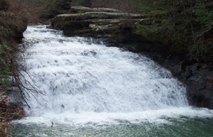
Sipsey:  The river that flows into Lewis Smith Lake out of the William B. Bankhead National Forest portion of the Warrior Mountains is  known by the Indian name Sipsey which means poplar tree or some say cottonwood tree.  The Sipsey Wilderness Area was established in 1975 and will be preserved and protected for future generations to enjoy. 

Tennessee River:  The river was originally called the Hogohegee or River of the Cherokees.  The Cherokees controlled the vast territory that made up most of the drainage of the Tennessee River.

Town Creek:  This creek was originally called Shoal Town Creek, because the Cherokee village of Shoal Town was located at the mouth of the creek and up the creek for some distance.  Shoal was finally dropped and the creek became known as simply Town Creek.  The creek actually follows the boundary of the present-day counties of Colbert and Lawrence of north Alabama prior to entering the Tennessee River.

Town of Cherokee:  The Cherokees established a village near the town in the late 1700's even though it was part of the Chickasaw Nation.  George Colbert stated that the Cherokees were living in the Chickasaw territory by his permission.

Tuscaloosa:  This Creek Indian village was actually the second Black Warrior Town, with the first located at the mouth of Sipsey River and the Mulberry Fork of the Warrior River and known today as Sipsey.  Both towns were named in honor of the great Creek Chief Tuscaloosa.  Tusca is the Creek word for warrior and loosa is the Creek word for black; thus, Tuscaloosa means Black Warrior.

Tuscumbia:  This town is named from the Muskogee words "tusc" meaning warrior, and "umbia" meaning one who kills; therefore, Tuscumbia means "warrior who kills"!  Chickasaw Chief Tuscumbia was the namesake of the city.

Warhatchie:  The younger brother of Doublehead was Warhatchie, and the community in Lauderdale County, Alabama known by the same name is probably in his honor.

Warrior Mountains:  These mountains are the northern drainage of the Warrior River which was originally known as the Tuscaloosa River or Black Warrior River.  The river is named in honor of the Creek Chief Tuscaloosa and the Creek Indian warriors.

Wednesday, November 9, 2011

Origin of Warrior Mountains

Origin of Warrior Mountains


       For thousands of years, inhabitants of the Moulton Valley have looked south to see a beautiful range of mountains rising from the flat middle plain in the heartland of Lawrence County, Alabama.  This east-west mountain range has represented many things to modern man, but probably was more important and sacred to our red ancestors than any of our European immigrants.  By the time of DeSoto’s visit to our state in 1540, our Muskogee people recognized the range of mountains as a tribal and geographic boundary along the Continental Divide.  The High Town Path or Ridge Path is a prehistoric east-west Indian trail that lies along the Tennessee Divide.  The divide begins separating the Atlantic’s coastal waters from those of the Mississippi drainage in Maine and continues through the upper Tombigbee watershed in the western portion of Alabama and into Northern Mississippi.

       Probably the most accurate and appropriate name for the north Alabama portion of this vast chain of mountains is derived from the Muskogee people who lived along the forest streams hundreds of years before white people came to our country.  The Creek word “taskagu” or “taska and the Choctaw word “tashka” refer to the English translation of “warrior” with the Muskogee word “lusa” meaning “black.”  We know from reading Alabama history, DeSoto encountered a giant of a man known as “Chief Tuscaloosa” or the Black Warrior; therefore, the name was here long before the first European settlers claimed the land in this southern portion of the Tennessee Valley.

       In early days, the stream forming south from the mountains became known as the Tuscaloosa (Black Warrior) River.  In a French map dated March 1733, Baron De Crenay, Commandant of the Post of Mobile, identified the southern drainage from our mountains as the Tuscaloosa River.  On other early maps, the main river, which drains south, was also called the Tuscaloosa.  Later in 1814 a map of north Alabama identified the river draining south of the Tennessee Valley as the Black Warrior River.

       In 1829, a frontiersman and famous rifle maker by the name of John Bull engraved two of his masterpieces from the Warrior Mountains.  One of the rifles was made for John Jarrett and the other was for David Smith.  According to information provided by Mr. Dan Wallace, the exceptional rifle is inscribed on a silver platelet in the stock, “John Bull for David Smith, Warrior Mountain.” The inscription on the silver cheek piece is as the following:
“Ann
This gun is named Charlotte,
from hills and mountains Came,
made to delight the heart of man,

with Joy, the laboring Swain,
And from the sportsmen of the day
Victorious bear the prife,
Away”

       According to Old Land Records of Lawrence County, Alabama by Margaret Coward, David Smith entered 79.92 acres of land in Section 36 of Township 7 South and Range 7 West, near Indian Tomb Hollow on September 12, 1818, and 79.92 acres on September 28, 1818, in Section 35.  He married Charlotte Ann Havens, who was the daughter of James Havens.  According to the Havens family legend provided by Spencer Waters, James Havens was buried next to his Indian friends on the side of the Warrior Mountains where the magnolia blooms in the Spring.  The graveyard is known as Indian Tomb Hollow Cemetery or Gillespie Cemetery.  After the death of James Havens around 1824,  his Indian friend John Brown was made executor of his estate.  Later James' daughter, Charlotte Ann Havens and her husband David Smith moved to Kentucky and carried the famous rifle with them. After the Civil War, one of the Smith's descendants fired the rifle at a turkey but forgot to remove the ramrod; thus, the ramrod became the only missing part of John Bull's masterpiece rifle. 

       In his 1899 book, Early Settlers of Alabama, Colonel Edmonds Saunders refers to the Tennessee Valley’s southern highlands of north Alabama as the “Warrior Mountains.” Later in 1918, when the government began organizing our mountains into a national forest the area was called the Black Warrior.  Today, the state wildlife management area is still known as the Black Warrior.  It is a shame that our forest had a name that could be traced back for over 400 years and has been changed to honor a white politician.  However, with the Indian pride that has grown strong in north Alabama, our mountains will never take second place.  These mountains will always remain the Sacred Land of our ancestors, and be known as the “WARRIOR MOUNTAINS.