Saturday, December 31, 2011

Walk in my Homeland

Walk in my Homeland

As a young country boy growing up in the foothills of the Warrior Mountains, I became very familiar with the creeks and woodlands of the northeastern portion of the Bankhead National Forest.  I grew up next to forest service property and was introduced to the mountains by my granddaddy.  Along the banks of West Flint Creek, I learned at an early age to hunt and harvest wild game from the woods, catch fish from the clear deep holes, gig suckers during their spring run, probe for mud turtles on sandbars in the creek bed during the late summer, to dig ginseng and other medicinal plants from the rich hillsides, trap furbearing animals during the winter months, and to follow a pack of hounds on dark dreary winter nights for possums and coons.  All these activities taught me a way of survival that my grandfather and other ancestors followed by living off what mother-nature provided.  My grandpa would always give me half the money from the night’s catch after the furs were stretched, dried, and sold.  If I assisted him with the trap line, he would always give me an equal share of the profits from the sale of the furs.  Many memories have lasted a lifetime were instilled within my heart and gave me a love for the great outdoors that I still have to this day.  It is my hope that I too can teach my grandchildren the ways of the wild and a love for the great outdoors

During the early years of my life, the adventures and activities with my grandpa occurred in the area of West Flint Creek drainage which was the central place of focus during my boyhood days.  Brushy Mountain, Sugar Camp Hollow, Indian Tomb, Beech Bottoms, McVay Hollow, Thompson Creek, Indian Creek, and the Mastengill Hole were just a few places that were the regular stomping grounds of grandpa and I.  These places were etched into my memory by day and also during the nighttime hunts.

Sacred Marker Tree in Indian Hollow Tomb by Rex Free

When I was too small to drive, the main area of my adventures were always within walking distance and were associated with that slow meandering creek which split the old Alexander Plantation.  During my youth, we lived for a while in an old clapboard house on the old plantation site where my father was a workhand on the farm of Mr. Joe Jacobs, who was the son-in-law of Mr. Jake Alexander.  Jake, the son of Thomas Jefferson Alexander and Sally Fitzgerald, managed to control the huge estate, even though he had a lot of siblings who also had a claim to the big farm.  After the Alexander Place was sold to Mr. Dallas Yeager, my uncle lived in the old plantation house while he worked for Yeager.  I remember spending many days playing with my cousins in the big house and exploring the farm.  The Alexander family built two other big plantation houses besides the one that Mr. Jake Alexander lived in that was just alike.  One was near the south end of the Drag Strip Road and was built for a daughter of Thomas Jefferson Alexander who married Captain Warren.  The other was built for Henry Alexander the half-brother of Jake and it is the only one still standing and is the home of Mr. Don Alexander.  The home still standing is about one mile east of Flint Creek Bridge on highway 36 on the north side of the highway.

West Flint Creek not only flowed through the Alexander Plantation but also formed the hollows and bottoms in the foothills of the Warrior Mountains.  A lot of the land surrounding the upper drainage of the creek is now part of the William B. Bankhead National Forest.  The creek began in the southeastern part of Lawrence County in Poplar Log Cove.  The limestone spring in the upper portion of the Poplar Log Cove was the source of a steady stream of water and was the beginning of the West Fork of Flint Creek.  The main tributaries near the southwestern beginnings of the creek were Wiggins Creek, Indian Creek, Thompson Creek, and Elam Creek.  Thompson Creek also had two important tributaries that included Gillespie Creek that flows through the center of Indian Tomb Hollow and Lee Creek that starts at Shiloh Church on the Leola Road.  It was along these creeks and hollows of West Flint that my boyhood life was formed in the tradition of my ancestors who depended upon the area for survival.  Not only did these woodlands provide my grandpa and I many wonderful meals of fish and wild game, but also provided my grandfather the major portion of his income during the winter and spring months.

The way of the wild sometimes seemed harsh but the rewards, even though small by todays’ standards, were great in the eyes of a young boy following his grandpa through the woods.  I knew that the animals taken would be a tasty meal after being prepared by my grandmother on the old wood cook stove.  She would help prepare and cook rabbits, squirrels, opossums, coons, muskrats, beaver, groundhogs, turtles, and fish for many daily meals.  In addition, my grandparents knew that the sale of medicinal roots, honey, wild meat, and hides would supplement their fall harvest of three to four bales of cotton grown on the poor hillsides.  Such was a way of life and the focal point of a lifelong adventure into a world not far removed from the old creek of a boyhood memory.

Today, I still hunt and roam the forest service property in the drainage of West Flint Creek and it always feels like it is my homeland.  Indian Tomb Hollow is still a very special place to me which I visit on a regular basis.  Each visit to Indian Tomb recharges my inner being and refreshes my spirit because I know I am walking the trails my ancestors walked for many generations.  

Wednesday, December 28, 2011

Indian Treaties of the Warrior Mountains

Indian Treaties of the Warrior Mountains

Indian people utilized the area of the Warrior Mountains for thousands of years before the coming of the white man.  Shortly before the first settlers arrived in the Warrior Mountains, many treaties had taken the last remnants of the native lands.  The following are some of the major treaties and events that impacted Indian people in north Alabama.

Chickasaw Boundary Treaty – January 10, 1786

The Chickasaw Boundary Treaty of January 10, 1786, recognized the High Town or Ridge Path along the Continental Divide in north Alabama as the Chickasaw’s southern boundary and Creeks northern boundary.  This early boundary between the Creeks and Chickasaws lay primarily along the present day Old Corn Road, Leola Road, Cheatham Road, Ridge Road, Byler Road, and other roads lying along the Tennessee Divide of the northern portion of the Warrior Mountains.  The backbone of North Alabama or divide was also the boundary line between the Cherokees and Creeks.  The boundary line along the divide with Chickasaw claims extending eastward to a north-south line drawn between the Path and Hobb’s Island or Chickasaw Old Fields just south of present day Huntsville, Alabama.  The north-south line lay along the Huntsville Meridian and formed the eastern boundary of the Chickasaw Nation until the Turkey Town Treaty of 1816.  From Ditto Landing or Hobbs Island, the Chickasaw boundary crossed present day Madison County about 45 degrees toward the northwest toward the Tennessee State Line.


North Alabama Indian Land Cessions
Colors represent different treaties!

Cotton Gin Treaty – January 7, 1806

The Cotton Gin Treaty of January 7, 1806, was between the Cherokee Indians and U.S. Government.  The treaty identified the tract of land that Moses Melton, the grandson of John Melton, lived on and declared the land to be equally shared property of Melton and Charles Hicks in equal shares.  Charles Hicks was noted in Cherokee history as being the first person to show Sequoyah how to write his name in English.  In addition, Chickamauga Cherokee Chief Doublehead controlled the Muscle Shoals area and directly benefited from the treaty that placed a cotton gin at his brother-in-law's John Melton.  The treaty gave up Cherokee claims to Indian land north of the Tennessee River, except for Doublehead’s Reserve, and placed the cotton gin at Melton’s Bluff in Lawrence County, Alabama.  Doublehead was killed because of the terms of this treaty.  Doublehead’s Reserve lay between Elk River (Chu wa lee) and Cypress Creek (Te Kee ta no-eh) in present day Lauderdale County.  The Cotton Gin Treaty with the Cherokees did not relinquish the Chickasaws claims to the area; therefore, Ft. Hampton was established to remove squatters from Chickasaw land, located primarily in the area of Limestone County known as the Simms Settlement.


Fort Hampton Historical Marker

Treaty of Fort Jackson - 1814

The majority of the new frontier in north Alabama was taken from the Creeks at the Treaty of Fort Jackson in 1814.  The Creeks did not receive monetary compensation for their vast sections of land from the Tennessee Divide or High Town Path to the south near Montgomery, Alabama.  This large tract was taken after Jackson’s defeat of the Red Stick Creeks at the Battle of Horseshoe Bend.  This 1814 cession of land was from the High Town Path or Continental Divide in north Alabama and extended south for nearly 200 miles.


High Town Path Historical Marker


Turkey Town Treaty – September 14-18, 1816

The Turkey Town Treaty of September 14, 1816, gave up Cherokee and Chickasaw land in the northern portion of the Warrior Mountains.  Both tribes had legitimate claims to the land by previous treaties.  According to the terms of the Turkey Town Treaty, the last Indian lands of the Warrior Mountains were bought from the Chickasaws and Cherokees on September 14 and 18, 1816, respectively.  The Chickasaws were paid $125,000.00 with the Cherokees being paid $60,000.00 for land that now makes up Colbert, Franklin, Lawrence, and Morgan Counties.  The Chickasaws and Cherokees had overlapping land claims with the Cherokees claiming land west to Natchez Trace some 10 to 15 miles west of Caney Creek in Colbert County.  The Chickasaws claimed land east to the old official Chickasaw boundary, which runs from the Chickasaw Old Fields (Hobbs Island) south to the High Town Path then west along the High Town Path to Flat Rock in present day Franklin County.  From Hobbs Island, the boundary ran northwest diagonally across Madison Counties.  The Chickamauga Chief Doublehead and the Cherokees farmed and controlled the Tennessee Valley to Natchez Trace by agreement with George Colbert.  

The Turkey Town Treaty signed by the Cherokees on September 14, 1816, ceded Colbert, Franklin, Lawrence, and Morgan counties; however, the U.S. Government established the Chickasaw’s new eastern boundary from Franklin County’s Flat Rock to Caney Creek in Colbert County until 1832.  The High Town Path was recognized as the southern boundary of the cessions for both the Chickasaw and Cherokee, until the Turkey Town Treaty of 1816.  The 1816 treaty identified the new cession boundary as a straight line drawn from Flat Rock in Franklin County to Ten Islands on the Coosa River.  Previous treaties recognized the Continental Divide along which ran the High Town or Ridge Path.


Depiction of Cherokees on Trail of Tears

Indian Removal Act - May 28, 1830

On May 28, 1830, congress passed an act authorizing the exchange of lands in the west for those lands east of the Mississippi River held by Indian tribes. President Andrew Jackson was intent on seeing all Indian people removed from the eastern United States.

Treaty of New Echota – December 29, 1835

On December 29, 1835, the Treaty of New Echota was signed by a small number of Cherokees.  The U.S. Congress ratified the treaty on May 23, 1836.  The treaty ceded the entire Cherokee territory east of the Mississippi River.


Trail of Tears – October 1838 to March 1839

The Cherokee people were given two years to move at which time the forced removal known as the “Trail of Tears” began in the Spring of 1838.  The forced march began in October 1838 and ended in March 1839.  An estimated 4,000 Cherokees died on the forced march to the west.  Many of the Cherokees from the east passed through north Alabama during 1838 by railroad from Decatur to Tuscumbia, Alabama.  By the time of the “Trail of Tears” in 1838, much of the land of the Warrior Mountains had already been claimed by the Celtic-Indian mix-bloods who denied their heritage in order to remain in the “Warrior Mountains”, the land they loved.

Conclusion

Many of north Alabama's Indian people were already mixed with white settlers and stayed in the hill country of the Warrior Mountains.  They denied their ancestry and basically lived much of their lives in fear of being sent west.  Full bloods claimed to be Black Irish or Black Dutch, thus denying their rightful Indian blood.  After being fully assimilated into the general population years later, these Celtic-Indian mixed-blood descendants began reclaiming their Indian heritage in the land of the “Warrior Mountains.”

Saturday, December 24, 2011

Alexander McGillivray and his Creek people

McGillivray & Creeks


         As soon as I hear the name Black Warrior, my heart swells with pride not only because I’m a descent of the noble Creeks, but also because of the beauty, peace, and tranquility of the majestic forest once known as the Black Warrior.  From pre-historic times, the Creek people inhabited the Warrior Mountains which was originally named after the great Creek Chief Tuscaloosa, Black Warrior, who was described in the DeSoto chronicles as being a giant of a man.  Tuscaloosa’s feet would just about touch the ground setting astride a Spaniard’s horse.  In later years, the forest in the northern portion of the Warrior Mountains was named after white politician, William B. Bankhead.


Creek Chief Tuscaloosa and DeSoto

         In order to write about the majesty of the Black Warrior or Tuscaloosa ( Tusca means Warrior,  Loosa means Black), now known as the William B. Bankhead National Forest, one must first explore the historic roots of such a land.  Probably the most powerful group of Indians ever known to exist was the great mound building society of Indians that once inhabited the land that became Alabama.  Their society spread east from the mighty Mississippi River, south to Florida, and north to the Great Lakes.  At least 100 years prior to Hernando De Soto’s expedition into Alabama in 1540, the great society began to break up.  Probably from this society arose the native historic Indians that inhabited the Black Warrior Forest of the Warrior Mountains, the original Alabama Indians collectively called the “Creeks.”

         Historically, the north boundary of the Creek Nation in north Alabama was the High Town Path, but they claimed the south bank of the Tennessee River.  The High Town Path or Ridge Path was a ridge top trail that followed the Continental Divide between the Tennessee River's southern drainage and the drainage of the Coosa River, Warrior River, Sipsey River, and Tombigbee River.  The High Town Path was some 1,000 miles in length and went easterly from the Chickasaw Bluffs (Memphis) on the Mississippi River through Copper Town in Mississippi, to the French Landing (Cotton Gin Port), then the path proceeded to Flat Rock in Franklin County.  The Path then traversed through Turkey Town (Gadsden, Alabama), to High Town (present-day Rome, Georgia), and then to Olde Charles Town, South Carolina.  The High Town Path intersected the Great War Path near Willstown, an Indian village just north of present day Fort Payne, Alabama.  The High Town Path through Lawrence County followed what are now the Ridge Road and Leola Road in the northern portion of William B. Bankhead National Forest.
        
         The Creeks, Chickasaws, and Cherokees were initially friendly with each other and were members of the Chickamauga Confederacy warring against the Americans who were taking their lands.  Three important leaders emerged as friends and cooperated with the British in their fight against the Americans during their revolution-Doublehead with the Lower Cherokees, James Logan Colbert with the Chickasaws, and Alexander McGillivray with the Upper Creeks.


Creek Chief Alexander McGillivray
Portrait by Archibald Robertson
         Alexander McGillivray was born Hoboi-Hili-Miko (Good Child King) in the Coushatta village of Little Tallassee on the Coosa River, near present-day Montgomery, Alabama.  His father, Lachlan McGillivray, was a Scots-Irish trader who built trading-posts among the Upper Towns of the Muscogee Confederacy, who had traded with French Louisiana.  Alexander's mother, Sehoy Marchand, was the daughter of Sehoy, a mixed-race Creek woman of the prestigious Wind Clan, and of Jean Baptiste Louis DeCourtel Marchand, a French officer at Fort Toulouse near Montgomery, Alabama.  Alexander and his siblings were born into the Wind Clan, as the Muscogee had a matrilineal system.
         Alexander was born on December 15, 1750 (or 1740) and as a child, he briefly lived in Augusta with his father, who owned several large plantations and was a delegate in the colonial assembly. In 1773, he was sent to school in Charleston, South Carolina, where he learned Latin and Greek, and was apprenticed at a counting house in Savannah, Georgia. He returned to Little Tallassee in 1777 where the revolutionary governments of Georgia and South Carolina confiscated the property of his Loyalist father, Lachland McGillivray, who returned to Scotland.  


         According to Carolyn Thomas Foreman (1929), Alexander McGillivray's description is as follows:  "He was of slender build, tall, with a commanding figure, and the immobile face which showed his Indian blood. Possessed of inordinate ambition and ability and a keen intellect, he was soon surrounded by warriors and adventurers...He was a very striking looking man, six feet tall, and erect in carriage. He had remarkably fine, piercing eyes and his forehead must have been very noticeable as all writers in describing him speak of the extraordinary expansion which commenced at his eyes and widened to the top of his head. He is said to have been handsome and to have had long tapering fingers with which he wielded a pen with remarkable rapidity. He was dignified and his manners were polished. He ordinarily dressed in a combination of Indian and American garments but he was provided with uniforms of Great Britain, Spain, and the United States which he wore on proper occasions, being careful not to appear in his American uniform when he was to meet Spaniards.  In his homes he entertained distinguished visitors with lavish hospitality and while he was ambitious and unscrupulous he had many fine traits, the best of which was his kind heart; he was celebrated for his kindness to captives and his last work in behalf of his nation was an effort to secure teachers for them".

         During the American Revolution, Alexander McGillivray was commissioned as a colonel in the British army. He brokered a British Indian alliance with Doublehead of the Lower Cherokees, James Logan Colbert of the Chickasaws, and other Chickamauga leaders.  Colonel Alexander McGillivray was a skillful diplomat and a great military strategist, but he rarely participated in battle.  At one time, McGillivray wielded great power commanding from 5,000 to 10,000 Creek warriors that became a major faction in the Chickamauga Confederacy.

         In 1783, Colonel Alexander McGillivray became the principal chief of the Upper Creek towns. His predecessor, Chief Emistigo, died while leading a war-party to relieve the British garrison at Savannah, which was besieged by the American Continental Army under General Mad Anthony Wayne.    Chief Alexander McGillivray died on February 17, 1793, and was buried in Pensacola, Florida at his friend William Panton's home, trading posts, and warehouses.  Panton, a powerful Scots-Irish trader of both British and Spanish goods, was a loving and dear friend of McGillivray, and he provide a place in his beautiful garden for McGillivray's last resting place.  After his death, Alexander's nephew William (Red Eagle) Weatherford would emerge as an important leader among the Creeks, and he would eventually surrender to Andrew Jackson after the Battle of Horseshoe Bend.

         After the death of James Logan Colbert on January 7, 1784, the Scots-Irish father of some important Chickasaw chiefs, the Chickasaws agreed to terms of peace with the United States Government.  As the Chickasaw people allied themselves with the United States and began helping the Americans who were pressuring the Creeks from the east and taking their lands, conflicts arose between the tribes.  Beginning in 1786, McGillivray commanded the Creeks to start making raids into the Chickasaw Nation, because the Chickasaw supported the United States Government efforts to force the Creeks from their homelands.    

         Even though the High Town Path was considered the Creek’s northern boundary in Lawrence County, they used trails crossing the Moulton and Tennessee Valleys in route to their buffalo hunting grounds near the French Lick (Nashville, Tennessee).  Probably the only historic battle between the Creeks and Chickasaws to take place in Lawrence County was the Battle of Indian Tomb Hollow.  The story about the Creek-Chickasaw battle which occurred in the 1780’s, some 7 miles south of Moulton, was published in the Moulton Democrat newspaper on November 7, 14, and 21, 1856.

         After the death of Alexander McGillivray, a temporary peace was established between the Creeks and Chickasaws in 1798; however, in 1814, peace between the Creeks, Chickasaws, and Cherokees was soon forgotten when the United States Government demanded the Chickasaws and Cherokees take up arms against the hostile red stick Creeks.  Upon the death of Doublehead on August 9,1807, the Creek Nation lost a friend and the support of the Lower Cherokees.  Eventually, the Chickasaws and Cherokees would help Andrew Jackson defeat the Creeks at Horseshoe Bend on March 27, 1814.  As a result of Indian assistance, the once powerful Creek Nation fell to Andrew Jackson’s forces.  The Treaty of Fort Jackson in 1814 relinquished thousands of acres of Creek Indian claims south of the High Town Path.  After Jackson’s defeat of the Creeks, the land of the Black Warrior (Bankhead Forest) was opened for settlement.  In 1815, Richard McMahan became the first documented white settler in the area near the present day Town of Haleyville.

         Only through intermarriage with white trappers, traders, and settlers, the Creek Indian blood of the Black Warrior was to remain in north Alabama’s Creek Indian descendants.  Presently, the Creek Indian blood still flows in the mixed-blood people of north Alabama.  As mysterious as the blending of a great mound building society from which the powerful Alabama Creek Nation arose, so was the vanishing of the Creeks of the Black Warrior.  However, the Creek blood line became evident in the early settlers of the forest who testified of their Creek Indian ancestry.


John Ridge


         As John Ridge, a great Cherokee leader, wrote 1835, “Our blood, if not destroyed, will win its course in beings of fair complexion, who will read their ancestors became civilized under frowns of misfortune, and the causes of their enemies,” so lives the remnants of the mighty Creeks of the Warrior Mountains.

Wednesday, December 21, 2011

Celtic Principal Chief

John Ross


Chief John Ross was a Celtic-Indian that was three fourths Scots-Irish (Celtic-pronounced Kel' Tic'), one eighth English (Anglo), and one eighth Cherokee (American Indian).  He served as Principal Chief of the Cherokee Nation for 38 years from 1828 through 1866.  He was born at Chief Little Turkey's Town or Turkey Town near present day Gadsden, Alabama on October 3, 1790 and died on August 1, 1866.  He was named after his Scots-Irish grandfather John McDonald.  His grandmother was Ann Shorey who was half English and half Cherokee and was the daughter of an Englishman William Shorey.  Ann also had a brother Will Shorey who was also half Cherokee and half English.


File:Chief John Ross.jpg
John Ross

McDonald immigrated to South Carolina from Scotland in the 1760's and by 1770 he had married Ann Shorey, daughter of Ghigooie, a Cherokee of the Bird Clan.  Even though Ann’s father had been English (Anglo-German origin), she had been reared fully as a Cherokee after Shorey died on Lieutenant Henry Timberlake’s journey back to England in 1762.  By 1771, John and Ann McDonald settled on Chickamauga Creek, some 15 miles south from its junction with the Tennessee River.  McDonald was appointed assistant superintendent or “deputy and commissary” of Indian Affairs for the British, under John Stuart.  McDonald was soon not only supplying Dragging Canoe, Doublehead, Bloody Fellow, and other leaders of the Chickamauga Confederacy with British supplies.  In addition, British agents were also actively helping to coordinate attacks against the frontier settlements in Georgia and the Carolinas, even to the extent of leading Chickamauga raiding parties.  The British were supporting the Cherokees as well as the Creeks, Chickasaws, Shawnees, and other tribes fighting the Americans. 

Scot-Irish trader John McDonald's  primary home in the Cherokee Nation was close to Chickamauga Creek south of the Tennessee River just southwest of Chattanooga, Tennessee where the Brainerd Mission was later located.  The British began to use the Chickamauga Town as a headquarters for their operations in the Southwest, stockpiling food and supplies there and using the area as a rallying point for all tribes of the Chickamauga Confederacy that were hostile to the Americans.  It is from this location during the Revolutionary War era from 1776 to his death on March 1, 1792, that the fierce Chickamauga Chief Dragging Canoe was supplied with British weapons, powder, lead, and suppiles to make war against the Americans…the Cherokees were seen as a barely containable force that could help tip the balance of power in early America one way or the other, and McDonald was seen as a possible fulcrum-for-hire, right at the center (Bishop, 2010).

But all of this came to an abrupt end in April 1779, when General Evan Shelby led an American attack against Chickamauga Town and the surrounding villages. The army burned all the buildings and destroyed the commissaries of McDonald and the other British agents, laying waste to the stores of food and plundering everything that could be carted off for sale, such as ammunition, furs, and horses (Brown, 1938).  The sale of the British items taken from McDonald's place is where Sale Creek gets its name.

“I … enclose you a letter from Colonel Shelby stating the effect of his success against the seceding Cherokees and Chuccomogga,” Thomas Jefferson (1779) reported to George Washington following the attack. “The damage done them was … burning 11 towns, 20,000 bushels of corn collected probably to forward the expeditions … and taking as many goods as sold for $125,000”.

The Chickamauga warriors were not present during the attack on McDonald's place.  When they returned to see the destruction around Chickamauga Creek, Dragging Canoe decided to relocate again, even farther from the American army, west of Lookout Mountain, forming what would become known as the “Five Lower Towns” of Nickajack, Running Water, Long Island Town, Crow Town, and Stecoe, or “Lookout Mountain Town”.  Doublehead, who controlled the Great Bend towns, had already moved to the Muscle Shoals and established Doublehead's Town at the head of Elk River Shoals in present-day Lawrence County, Alabama.

Though the Americans had officially declared the Revolution over on April 11, 1783, the Chickamauga Confederacy fought on from their new base at the Five Lower Towns and from Doublehead's stronghold at the Muscle Shoals.  By 1784, John McDonald was back in business and returned to help the Chickamauga forces by providing British war supplies.  He set up shop at Running Water, a town situated at a creek crossing on the Tennessee River, just west of Lookout Mountain.  McDonald with the help of British agents were supplying arms to several Chickamauga leaders and others living around Running Water and the lower towns, but he was still were within twenty miles of his original home of Chicamoggy (Chickamauga Creek).  The British agent Alexander Cameron was living at McDonald's and supplying goods and ammunition from Savannah or Augusta.  Cameron in the course of the war was a murderer and robber, and frequently went out with the Chickamauga Indians on raids against the settlers.

In 1785 John McDonald ransomed the life of a young Scots-Irish man by the name of Daniel Ross that was a captive of Bloody Fellow.  Since McDonald’s mother was Barbara Ross, he may have saved Daniel Ross because of their kinship or they may have been cousins.   Daniel Ross became McDonald’s business partner and ran a trading post at Stecoe or Lookout Mountain Town.  Later Daniel Ross would marry McDonald’s daughter Mollie and become the father John Ross.


About 1788, John McDonald and Daniel Ross were feeling the pressure of war and moved their trading posts together with their families to Turkey Town in Alabama, and continued living among and supplying the Chickamauga Confederacy.  Little Turkey was the Principal Chief of the Cherokee Nation and resided in his town near the Coosa River.  Little Turkey's Town was also much closer to the old abandoned French Ft. Tolouse, and there was talk being circulated that it might be re-garrisoned by the Spanish or that a new fort would be garrisoned just north, near the current site of Ft. Payne, Alabama.
  
It was at Turkey Town, near the present location of Center, Alabama on the Coosa River, where John Ross was born to Daniel Ross and Mollie McDonald on October 3, 1790; therefore, John Ross was born during the Chickamauga War and was a Chickamaugan by birth.  During his boyhood, he lived among the Chickamauga people who had fought fiercely to keep their homelands.  John Ross grew up in the aftermath of the Chickamauga War and became principal chief of the Cherokee Nation during the removal period.   Ross would fight just as fiercely as the Chickamaugans to keep the lands of their Cherokee ancestors.


John Ross Home Historical Marker, Rossville,GA


At the time of John Ross' birth his grandfather, John McDonald was corresponding with William Panton of Panton, Leslie and Company, a British supplier of trade goods that had become allied with the Spanish interests.  By 1800 through peace treaty agreements with the United States and Cherokees, John McDonald got to move back to his original Chickamauga home some 15 miles south of the Tennessee River near present-day Chattanooga, Tennessee.  It was not until turning his home place at Chickamauga over for the establishment of the Brainerd Mission in 1817 that McDonald finally retired to the newly constructed home of his grandson, John Ross. 


John Ross House - DoChattanooga
John Ross Home near Chattanooga, Tennessee

  The John Ross faction, who fought removal against the wishes of the Ridge/Watie faction that signed the Treaty of New Echota, was friends of Doublehead’s relatives who were already in the west.  During the Trail of Tears, Quatie, John Ross's full Cherokee wife, died on the trail along with some 4,000 Cherokees before reaching Indian Territory.  Doublehead’s assassination and other factors culminated in a blood bath when both factions came together in the west.  Doublehead's son Bird Tail Doublehead and his close relatives killed Major Ridge when Ridge got to the west.  The Ross faction was probably responsible for some 70 deaths when the Cherokees got to the west as revenge of Doublehead's murder by Ridge and for the Ridge Party signing the Treaty of New Echota which sealed the removal of Cherokee people.


Major Ridge

Sunday, December 18, 2011

Kinlock

Kinlock

            On the western edge of the High Town Path in Lawrence County, an important mountain community was known as Kinlock.  According to several early maps, Kinlock was located in the area of the present-day Macedonia Church near the junction of the Kinlock and Byler Roads in southwestern corner of Lawrence County, Alabama.


Kinlock Historic Marker

            Since Kinlock Rock Shelter and Spring were approximately one mile southeast of the dividing ridge along which the High Town Path ran, the Kinlock sites were heavily used by both prehistoric and historic Indian people as well as early settlers. The Kinlock site provided early travelers of the northern portion of the Warrior Mountains a source of water and also shelter during severe weather.  The Kinlock Shelter is a premier petroglyph site in the State of Alabama.


kids hiking
Kinlock Rock Shelter

                        According to Two Hundred Years at Muscle Shoals,the first state highway provided for by the legislature meeting in Huntsville in 1819 was built through Bainbridge.  It started from the Great Military Road on the west side of Shoal Creek in Lauderdale County, crossed the river at Bainbridge and passed south through Jeffers Cross Roads (Leighton) on through old LaGrange, Kinlock, Haleyville, Eldridge, Bankston to Tuscaloosa.  While John Byler and his associates were authorized to build only a portion of the road south of Franklin County, the old turnpike, short sections of which are still in use, was known as Byler’s Turnpike Road.  The road was directed to be twelve feet wide, clear of stumps and roots, and good causeways were planned for all soft places.  The Byler Road was to facilitate travel from Nashville to Tuscaloosa, and, after the latter became the Capital of Alabama, in 1826, was a much used way, for many of our early settlers were from Tennessee and Virginia and used this route” (Leftwich, 1935).

            The Old Buffalo Trail that became portions of the Byler Road and the High Town Path ran along the Continental Divide in the Kinlock portion of Bankhead Forest for some five miles.  Both roads lay along the dividing ridges and east of the upper watershed of Bear Creek.  The Byler Road turned south with the High Town Path traveling west along the Continental Divide south of Bear Creek to Flat Rock in Franklin County.  The High Town Path became less important as river ferries and passage through Indian lands were obtained through treaties.


Byler Road Historic Marker  

            The Byler Road was built by John Byler and associates and was one of the first legislative acts of the State of Alabama.  According to Lawrence County Deed Book C, pages 28 and 29, John Byler in March 1824 deeded Jacob Byler the undivided third part of the road known as Byler’s Turnpike Road.

            The Kinlock area saw a great deal of action during the Civil War.  Supposedly a detachment of Colonel Able Streight’s regiment was sent to Kinlock to take the grain and destroy the grist mill.  Somewhere along or near the High Town Path portion, the Yankees of Northern Aggression were ambushed with the aid of the Cherokee family of Jane “Aunt Jenny” Bates Brooks Johnston, her family, and local settlers.  Some accounts say that three to seven Yankees were killed in the ambush and were buried in the slave cemetery at Kinlock.  Also during the Civil War, Aunt Jenny’s husband Willis and son John were taken and later killed by some soldiers that were members of the Home Guard and their bodies dumped in Denton Hollow in nearby Franklin County.


Jane "Aunt Jenny" Bates Brooks Johnston
1/2 Cherokee Indian

            Later in the War of Northern Aggression during March 1865, General James Harrison Wilson organized the world’s largest cavalry of 13,480 horses at Gravely Springs in Lauderdale County.  Wilson’s cavalrymen eventually engaged the Confederates at the Battle of Selma.  One of the three divisions of the Wilson’s Civil War Cavalry rode along the High Town Path portion of the Byler Road to Kinlock.  On March 24, 1865, Union General Edward Winslow with a portion of Major General James H. Wilson’s 14,000 men passed along the Poplar Springs area in route to Selma via Kinlock and Hubbard’s Mill.  The Union division camped overnight at Hubbard’s Plantation around Kinlock Spring (Elliott, 1972). 

General Edward Winslow

            Major David Hubbard, who had a plantation home and mill near Kinlock Falls, was appointed Federal Commissioner of Indian Affairs of the Confederate States of America by President Jefferson Davis (Graves, 1985).  Major Hubbard had a cotton factory on the High Town Path south of Bear Creek.  According to an early Alabama map, Hubbard’s cotton factory was located west of his plantation home on the High Town Path.  Hubbard’s home and grist mill were located at Kinlock Falls and Spring in Lawrence County’s southwest portion of Bankhead Forest.

            During historic times, one of the most colorful Cherokee Indian ladies to ever settle in Bankhead Forest lived at Kinlock on the historic High Town Path and Byler Road.  She went by the name of “Aunt Jenny” and many times she aided weary travelers of the High Town Path.  Aunt Jenny deeded some of her Kinlock land for the location of Macedonia Church.  All five of her sons and some of her grandsons were shot and killed.  Aunt Jenny stated that her sons died with their boots on.  She, along with some of her children, is buried in Poplar Springs Cemetery, just north of the Kinlock Community and a few yards west of the High Town Path. 

            Another Cherokee Indian lady of historic times whose family settled along the High Town Path in the Kinlock area was Mary Tennessee Garrison Spillers.  Her son, Amos Spillers, who lived for awhile at Kinlock, became the first conservation officer of Bankhead National Forest and is buried in the forest at Mt. Olive Cemetery (Manasco, 1981).  Many people who are descendants of Aunt Jenny and Mary Tennessee still live in north Alabama.  Read more about early Indian paths and trails in the soon to be published book, Indian Trails of the Warrior Mountains and Southeast by Rickey Butch Walker and Lamar Marshall.

Thursday, December 15, 2011

Wildlife Lost from Warrior Mountains

Wildlife Lost from Warrior Mountains

Brown’s Spring is approximately 1/4 mile west of the Old Looney’s Tavern Historic marker on highway 41 in Winston County.  It was at the spring in the fall of 1890 that the brisk October air was chilled from an early morning frost.  The spring was flowing with fresh cool water capable of satisfying the thirst of both the hunters and their dogs.  Excitement was in the air as the hunting party gathered at the spring to organize their day in the woods to obtain meat for their families.  Sidney Walker, my great grandfather, was standing with other members of the party and talking about the day’s hunt.  The stock of his rabbit-eared muzzle loading shotgun was resting on the ground with him leaning against it for support.  One of the big bear and deer hounds stood up against my granddad for a pat on the head. As the big dog dropped back to the ground, one foot caught the rabbit-ear hammer causing the shotgun to discharge into my grandfather’s stomach and chest.  Sidney died shortly after the accident.  He never knew the big game animals he longed to hunt would disappear from the Warrior Mountains within a few years.

This true account is a sad beginning to a story about the demise and disappearance of large game animals, beautiful birds, and majestic trees that once were a vital part of the primeval wilderness of the Warrior Mountains of north Alabama.  Hunting parties, an important part of wilderness life, provided a means of obtaining meat for hungry families, hides and furs which could be traded for goods, and the thrill of the hunt along with the fellowship of friends and neighbors.  However, unregulated hunting practices began taking their toll on the native wildlife.  Between the 1800's and early 1900's, several big game species were eliminated from the Warrior Mountains by “over hunting”.  This tragedy is believed to have eliminated wildlife such as the eastern buffalo, eastern elk, black bear, timber wolf, and the eastern cougar.

Whitetail Deer-The deer were not completely eliminated, but their numbers were so low that the conservation department decided to restock the area.  After the last original Warrior Mountains whitetail deer were drastically reduced from the forest, this herd was restocked with a northern subspecies of deer from Iron Mountain, Michigan during the 1920’s.  Again in the 1990’s, deer from South Alabama were restocked in the Black Warrior Wildlife Management Area.

Mr. Rayford Hyatt, past conversation officer of Bankhead, relates an interesting story about the last native deer to be killed in the forest.  According to Mr. Hyatt, the last pure blood line deer was a small racked buck that was hunted for two or three days by hunting parties before it was eventually killed.  The deer was killed by James M. Flanagin on Hagood Creek in early 1909.  Mr. Amos Spillers, one of the first conversation officers of Bankhead Forest, had the antlers of the last known native Bankhead whitetail deer.  Many people came to view the antlers of this beloved wildlife creature which was once taken for granted by many in the forest.


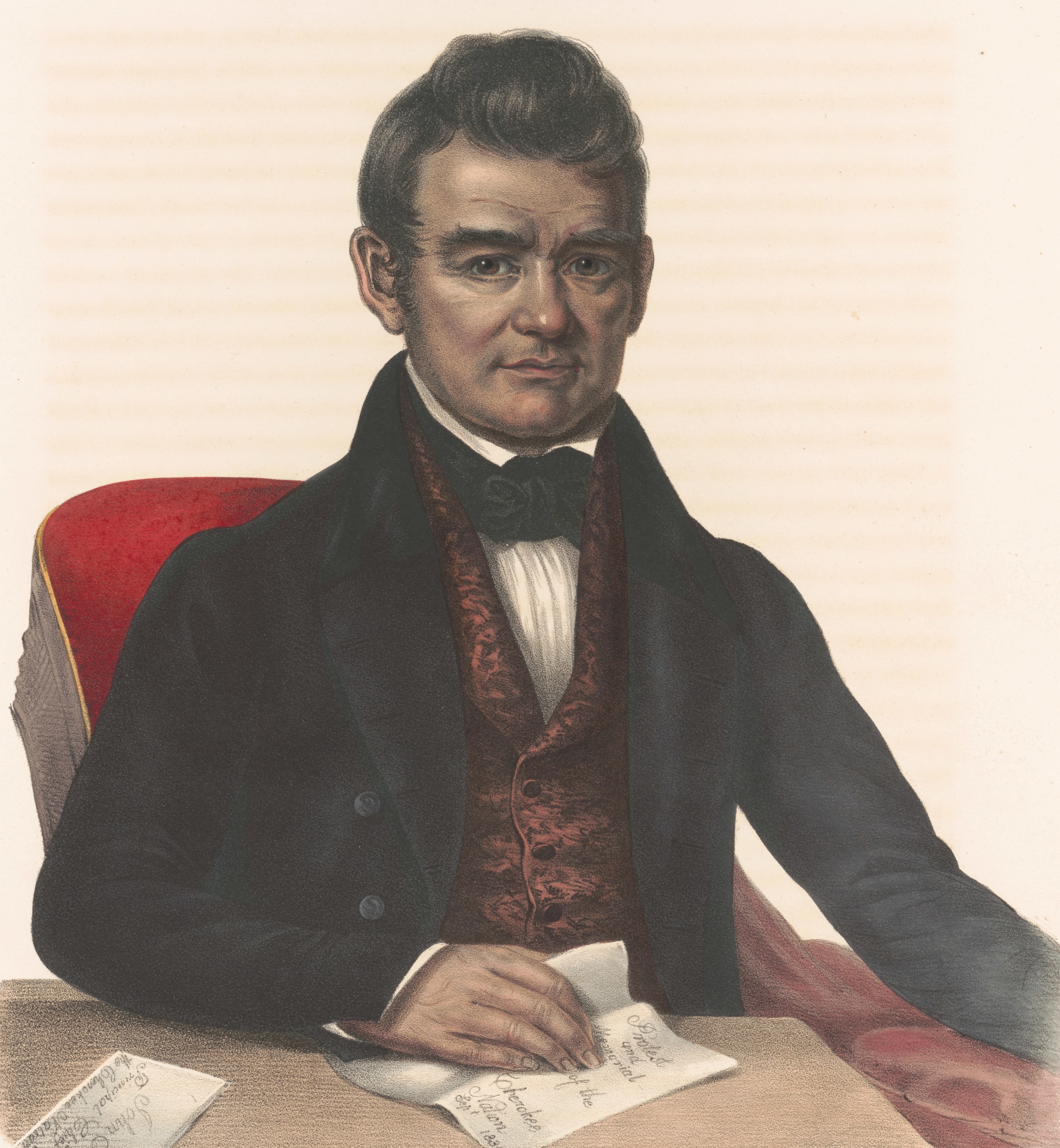
Timber Wolf-According to Mr. Hyatt, the last known timber wolf of the Warrior Mountains was killed during snowy weather in the Hurricane Creek area in 1910 by William Straud Riddle.  William Straud Riddle, the son of Jonson (Rake) Riddle and Martha, was at least ¾ Cherokee Indian.  His father was a full blood and his mother was ½ Cherokee.  The wolf had killed several sheep owned by a Mr. Sewell who resided south of Grayson.  After hunting and tracking the wolf in the snow nearly all day, the hunt ended without success.  As Mr. Riddle started home toward the western side of Sipsey River, he found fresh wolf tracks in the snow.  After tracking the animal a short distance, he saw the wolf standing next to a huge hollow log where it had a den.  Once the wolf was shot and killed, it was taken home and placed in a standing position before it became stiff.  After eating several sheep, the wolf was huge and weighed some 150 pounds.  Many people came to see the carcass before it was finally discarded.  

In the early days of Franklin and Lawrence Counties, wolf scalps could be used in the payment of taxes.  Notice in the following law:

ACTS OF ALABAMA 1835 SESSION. ACT NO. 123 Pages 119,120
            “After passage of this Act, it shall be lawful for Tax Collectors of Franklin and Lawrence Counties to receive all wolf scalps in payment of any county tax due from any person in the county, on prior affidavit made before an acting Justice of the Peace that the wolves were killed in Franklin or Lawrence County, as the case may be – Scalps received at the following rate; all scalps under one year $1.00; all scalps one year and upward $1.50; Tax Collector of each county to return affidavits with scalps to the County Treasurer as money for any county tax due from them as tax collectors – no money to be paid out for scalps; only receive scalps in payment of taxes.”


Black Wolf

Three species of wolves were known to exist in the Warrior Mountains; grey (timber), black, and red wolves.  This last known black wolf was shot in 1917 and is now considered extinct.  The red wolf is recovering from the verge of extinction with one small pack re-established in Cades Cove of the Smokey Mountains National Park.  The timber or grey wolf is found only in the northern portion of the United States.

Black Bear-The black bear was were eliminated from the Warrior Mountains as a breeding population in the early 1900’s.  Specific information about the demise of the last black bear is unknown; however, many mountaineers tell stories of encounters their grandparents had with bears during the early 1800’s.  Black bears loved corn and would attack the corn fields when the corn was in the roasting ear stage.  Be sure to read about Dave and the black bear and Nancy and the bear cub in my Warrior Mountains folklore book.  Nancy nursed a small cub until it got so big it would tear her clothes.  Another interesting story is about Jacob Pruitt on his horse chasing a bear when he was thrown from his horse and killed by the black bear.  Reports of bears still persist to this very day, but no known population of either in the Warrior Mountains.  Black bears are still found in Tennessee, Florida, and the swamps of extreme south Alabama. 

 Eastern Cougar-The eastern cougar was known locally as the "painter or black panther" and struck fear in the early settlers of the Warrior Mountains of north Alabama.  In the book Warrior Mountains Folklore, older people remember their grandparents talking about panthers.  It is estimated that some 30 wild eastern panthers still roam the swamps of Florida and rank as the most endangered animal in the Southeastern United States.

Elk-The eastern elk migrated along the Appalachian and Cumberland Mountains in Alabama and Tennessee in the early 1800’s.  The elk were rapidly eliminated by Indian and early settler hunters.  The eastern elk were killed out in the state of Tennessee by 1870.  No known record exists on the demise of eastern elk in the Warrior Mountains of Lawrence County.

Eastern Bison or Buffalo-The eastern bison or buffalo ranged from the Great Lakes into Florida.  The eastern buffalo was much larger than the western buffalo was very black.  By the late 1700's all the eastern bison were killed out of the Warrior Mountains.  A major factor for the Chickamauga War carried out under the leadership of Dragging Canoe and Doublehead was the loss of their sacred buffalo hunting grounds.  Dragging Canoe said, "The Buffalo are our cattle".  The last known eastern bison were killed out in the southeast by the 1820's.

Passenger Pigeon-Passenger pigeons were beautiful birds that once filled the skies and woodlands of the Warrior Mountains.  Old-timers have passed down stories of passengers pigeons.  The birds were extremely abundant and flocks containing thousands of birds roosted in mature hardwoods.  The passenger pigeons, much larger but similar to an oversize mourning dove, would use the same roost for years.  One such roost existing in the northern portion of Bankhead was near the forks of Thompson and West Flint Creeks, and also on Sipsey River.  Other places in surrounding areas immortalized the name of the passenger pigeon by being named “Pigeon Roost.”  The pigeons were smoked out at night while on the roost by huge bond fires.  They were also shot and killed at their nesting sites.  Eventually, this beautiful wilderness bird was eliminated from Warrior Mountains with the last verified flock appearance in Alabama in 1893.  Eight of these birds were killed before this flock of some three hundred birds flew away never to return to our state.  The last known passenger pigeon died while in captivity on September 1, 1914, at the Cincinnati Zoological Garden.  This wilderness bird that once fed on the giant chestnut, oak, beech in Warrior Mountains is now extinct.


Passenger Pigeon

Ivory-billed Woodpecker-The ivory-billed woodpecker, another large bird once native to the Warrior Mountains, is on the verge of extinction due to habitat destruction as well as needless killings.  The last known ivory-billed woodpecker in Alabama died about 1906.  The bird met its fate at the hands of a hunter who probably never considered his kill would be the last of the species reported from our state.
The ivory-billed woodpecker’s form was mystic and immortalized by prehistoric Alabama Indians who engraved its image on stone plates, handles of  axes, and other ornaments of the Mississippian culture.  If our modern ancestors had cared that much for this bird of mystery, our children today might have been blest not only by sight of the bird but also by the sound of its hammering beak in the hills and hollows of the Warrior Mountains.


Ivory-billed Woodpecker


Carolina Parakeet-The Carolina Parakeet was probably the most colorful and beautiful bird to inhibit our Warrior Mountains.  In early 1819, Anne Royalle describes flocks of the birds in Lawrence County with their beautiful green and yellow plumage.  The fatal flaw of the Carolina Parakeet was their love for ripening fruit and corn.  When one bird was wounded, the others would hover to help.  This endeavor caused the whole flock to become easy prey.  Eventually, the Carolina Parakeet was totally wiped out, never to be seen again in the Warrior Mountains.  The Carolina Parakeet is now extinct.


Carolina Parakeets

American Chestnut-The American Chestnut, the largest nut producing tree in North America, was once abundant in the Warrior Mountains.  It is now sometimes found as only a small sapling or tree struggling for survival.  With some documented to be 13 feet in diameter, these giant nut producers once claimed, if in a pure stand, millions of acres of timber land in the eastern United States.
In about 1910, Chinese Chestnuts, which carried the deadly chestnut blight, were imported into New York.  The mistake proved to be very costly.  By the late 1930’s, the blight had spread like wild fire down the eastern coast killing all the American Chestnuts in its path.  Chestnuts of the Warrior Mountains also fell victim to the terrible blight.  The Indians, early settlers, and wildlife of Bankhead once utilized the bountiful production of nuts from the majestic chestnut.  Today, the American chestnut survives as a frail sprout in the Warrior Mountains.

Conclusion-Now over 110 years since the death of an early hunter of the Warrior Mountains in 1890, we look back with grief and sadness at the devastation wreaked upon our beautiful forest and its wildlife.  But as the mighty American Chestnut reduced to its frail existence as a lowly shrub returns year and year from sprouts of the life giving stump again to claim its glory, new ecology warriors will arise to fight for the protection of our beloved land known as the Warrior Mountains.